
Real Estate Drone · Costa Blanca
Real estate drone photography: why location is part of the property story
A property is not defined only by what it is, but also by where it is.
A terrace may be attractive. A pool may catch someone's attention. A villa may have striking architecture. But there is something photography from ground level cannot always explain: how the property relates to everything around it.
That is where real estate drone photography and video can add a different kind of information.
The purpose is not simply to create an impressive aerial image. The real value of drone imagery in property marketing is context: showing the plot, views, development, proximity to the sea, a golf course, green areas or the relationship between different parts of a home.
In areas such as Torrevieja, Orihuela Costa and Costa Blanca South, where the surroundings are often part of the experience of the property, that context can be just as important as presenting the interior correctly.
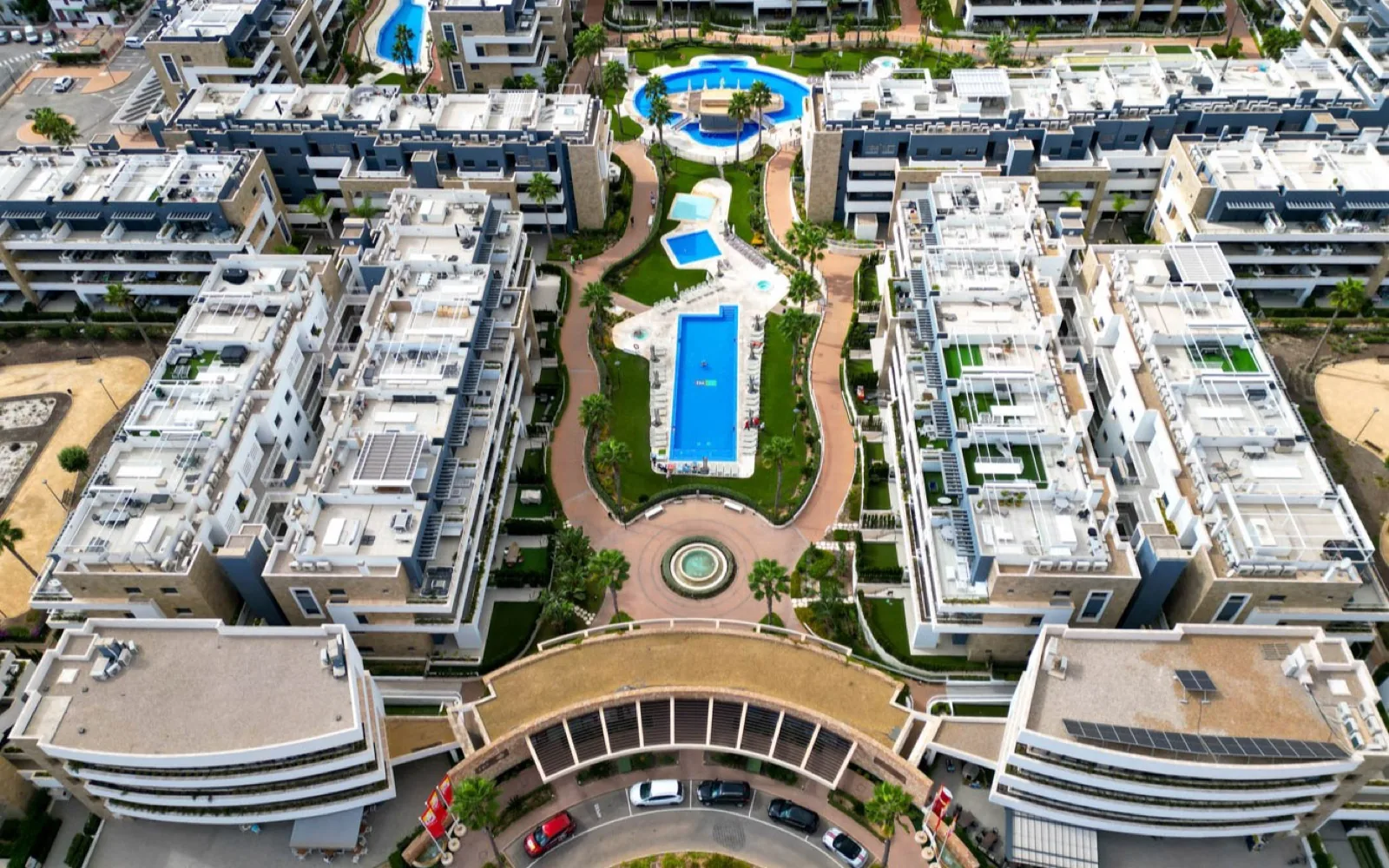
What a drone can show that we cannot see from the ground
Ground-level photography remains essential for presenting a property. It shows interiors, materials, layout, terraces, pools and many of the details buyers need to understand the home.
But that point of view has limits. Raise the perspective and information that was previously hidden becomes visible.
- How the plot is organised.
- The real scale of outdoor areas.
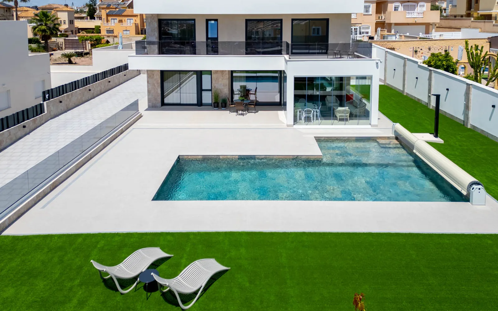
- Where the pool sits in relation to the house.
- How the property fits within its development.
- What surrounds the property.
- The orientation of important outdoor areas.
- The relationship with the sea, a golf course or natural surroundings.
- The scale of the property as a whole.
Aerial property photography does not replace photography from the ground. It complements it by answering different questions.
Location is also part of the property
When someone searches for a home, they are rarely evaluating only four walls. They are also evaluating an area.
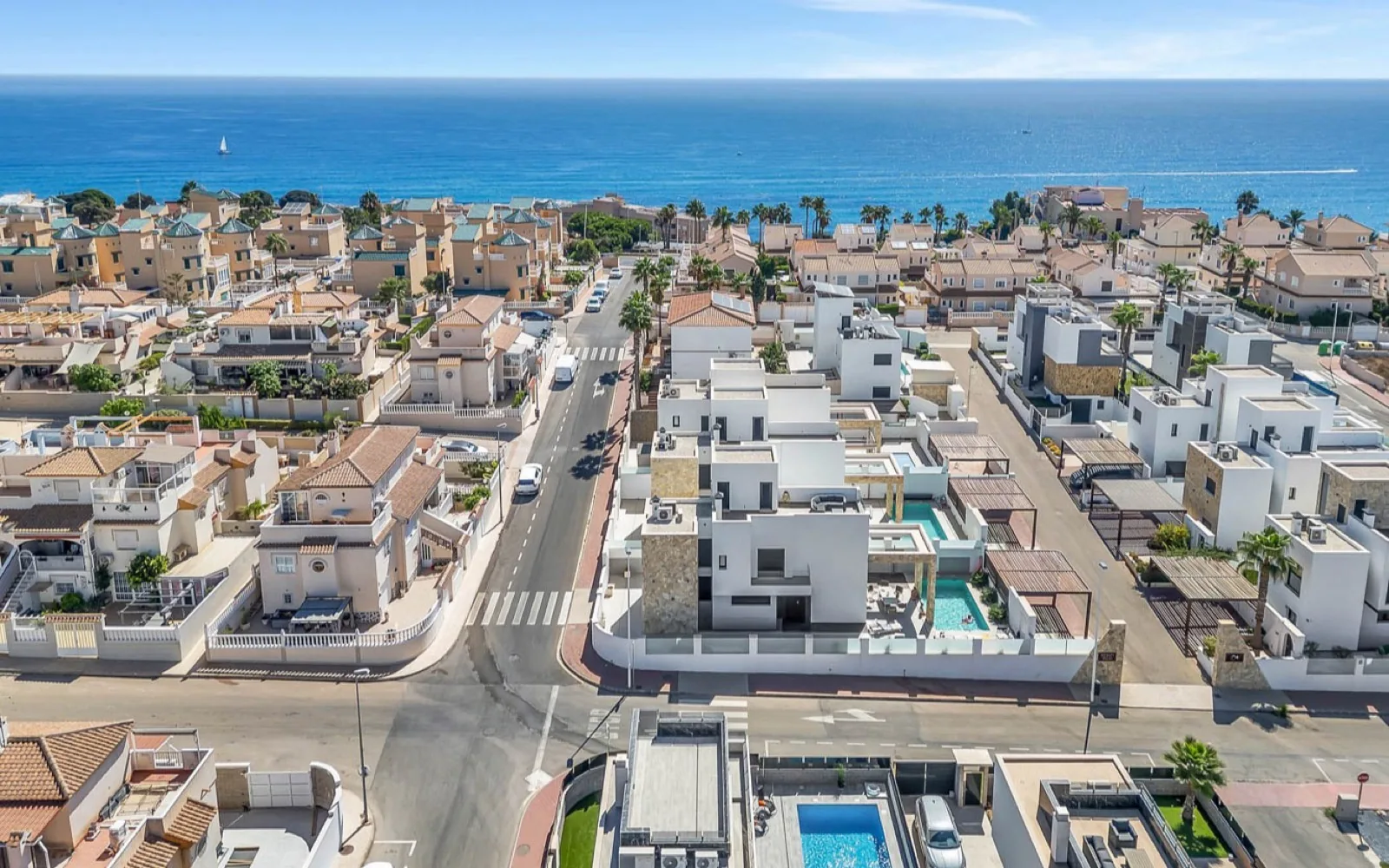
For some properties, location is one of the strongest selling points. A villa may be only minutes from the sea, but a photograph taken beside the pool may not communicate how close the coast actually is.
An aerial view can explain that relationship in seconds. The same applies to homes beside golf courses, properties facing green spaces or residential developments close to particular amenities.
The objective is not simply to produce a beautiful image. It is to make information visible that helps a buyer understand where the property is and what living there may feel like.
Show the surroundings without losing sight of the property
One of the most common mistakes in real estate drone content is turning the production into a tourism video.
The surroundings matter, but there should be a clear visual relationship with the property. A strong aerial shot should communicate: this is the home and this is what surrounds it.
Every drone shot should have a purpose. Some communicate scale, others location or views, while others explain the plot or visually connect the home with its surroundings.
Villas, plots and properties with substantial outdoor space
Some properties benefit particularly from an aerial perspective. Villas are a good example.
From the ground we can photograph the façade, pool, terrace and garden separately, but it may still be difficult to understand how those spaces connect.
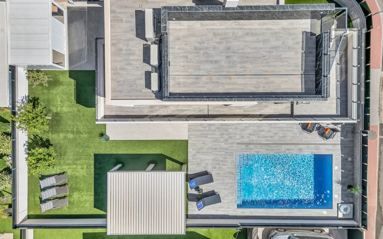
From above, the house, pool, garden, terraces and plot can be shown within one composition.
This makes it easier to understand the property as a whole and is particularly useful for detached homes, large plots, estates and developments where outdoor layout forms an important part of the property.
Residential developments and communal areas
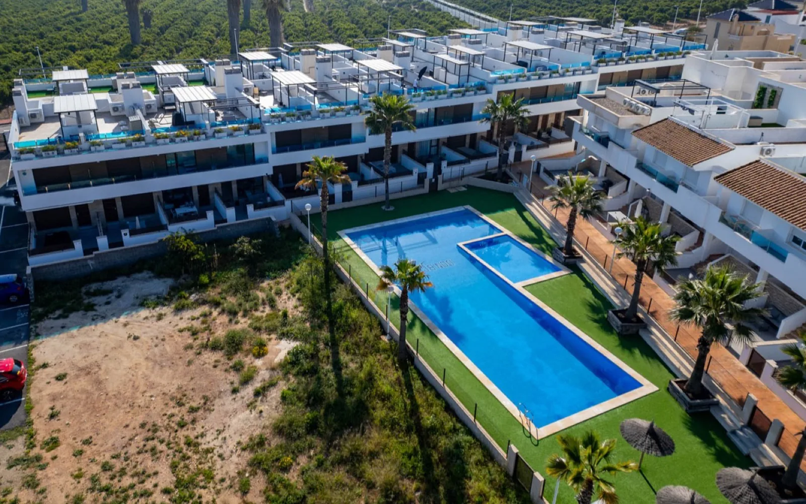
For apartments and residential developments, the value of drone imagery can be different.
The interior may be perfectly explained with conventional real estate photography, while an aerial perspective can reveal the scale of a communal pool, green areas, the position of different buildings and the overall layout of the development.
When communal facilities are an important part of the property, aerial imagery can present the residential complex as a complete environment.
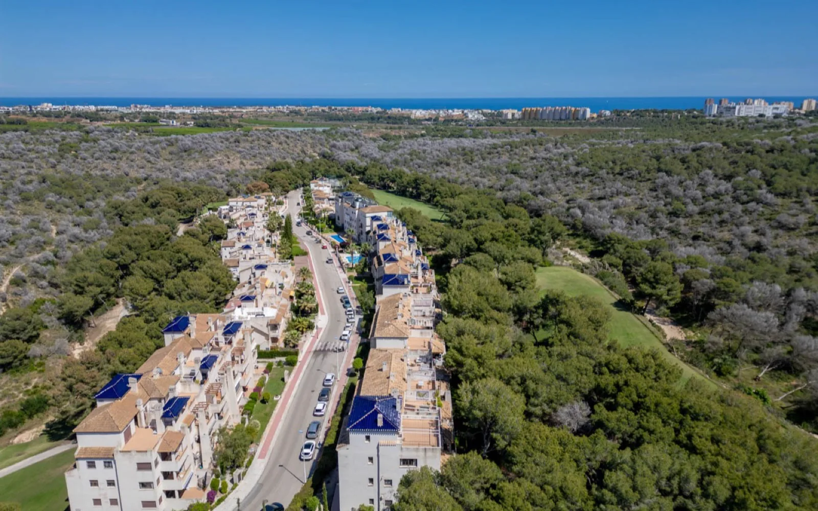
Sea, golf and landscape: when the surroundings are part of the value
Many properties on the Costa Blanca are closely connected to their location: homes near the Mediterranean, developments beside golf courses, properties with open views and houses surrounded by green areas.
In these situations, aerial property photography allows that context to become part of the visual story.
The sea does not need to dominate the frame and the golf course does not need to become the main subject. The property remains central.
But showing the visual relationship between the property and these surroundings can communicate far more than simply writing that the home is a few minutes from the sea.
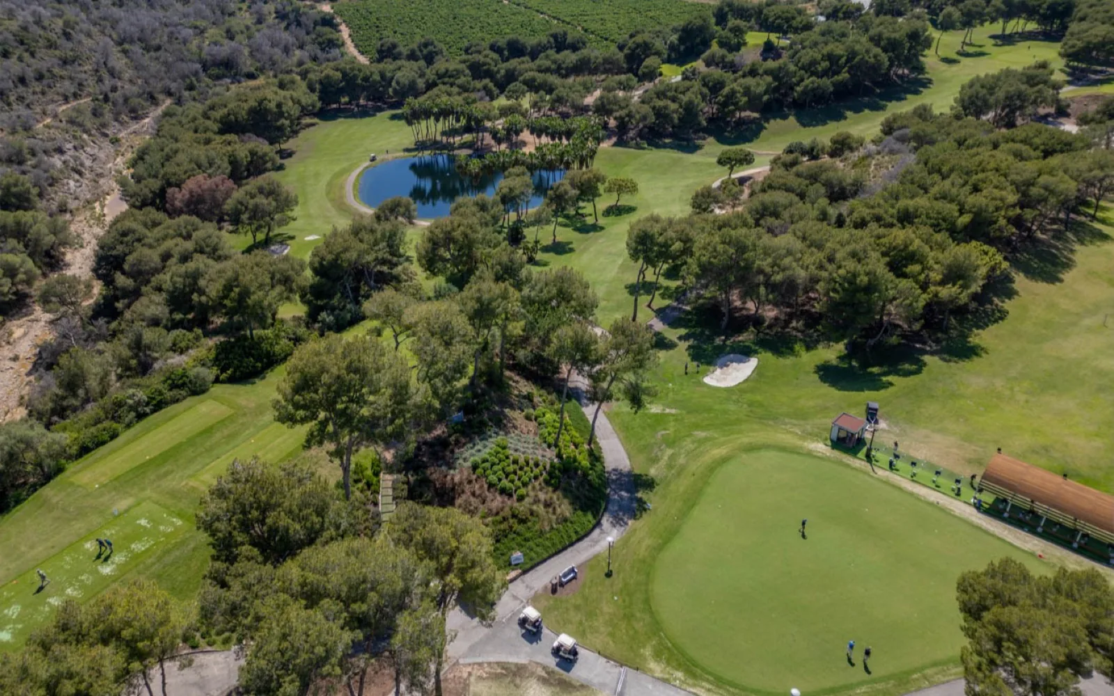
Aerial photography or drone video: they do not serve exactly the same purpose
Aerial real estate photography
A still image allows the viewer to study the composition and quickly understand spatial relationships. It is particularly useful for plots, pools, gardens, developments, views, location and overall scale, and can be used on property portals, websites, presentations and digital campaigns.
Real estate drone video
Video adds movement. An aerial sequence can begin with the surroundings and gradually approach the property, or start at the home and open outward to reveal its location. That movement creates a natural connection between property and place.
Does every property need drone imagery?
No.
A property can be presented perfectly well with ground-level photography and video when the exterior context adds little to the story.
Drone imagery becomes much more useful when there is something meaningful to explain from above.
- A large plot.
- Pool and garden.
- An attractive residential development.
- Open views.
- Proximity to the coast.
- Golf.
- Communal areas.
- Exterior architecture.
- A particularly valuable relationship with the surroundings.
Using a drone simply because it is available does not automatically improve a production. The perspective needs a reason.
Drone imagery works best as part of a complete production
A property has different things to communicate.
Real estate photography lets buyers study spaces. Video can recreate the feeling of moving through them. Reels and vertical video are designed for social platforms. Drone imagery adds another layer: location, scale and surroundings.
When a property needs a complete visual production, planning these formats together makes sense. During the same production we can decide which spaces work best as photographs, which benefit from movement and which information deserves an aerial perspective.
The result is not simply more files. It is a more complete presentation of the property.
Real estate drone photography in Torrevieja and Costa Blanca
The type of property found across Torrevieja, Orihuela Costa and Costa Blanca South makes aerial imagery particularly useful in many situations.
Detached villas, residential developments with pools, homes near the sea, properties beside golf courses and houses with substantial outdoor areas are all examples where an aerial image can communicate information that is difficult to show from ground level alone.
We work in areas including Torrevieja, La Mata, Orihuela Costa, La Zenia, Villamartín, Ciudad Quesada and Guardamar del Segura, as well as other Costa Blanca locations depending on the production.
Before using a drone, we consider both what needs to be communicated and the flight conditions and possibilities of each location.
A different perspective only has value when it explains something
A strong real estate production is not about accumulating spectacular images. It is about showing the right information from the right point of view.
Some characteristics of a property are simply easier to understand once we stop looking at it only from ground level.
An aerial view can reveal an entire plot, show the sea beyond a development, explain how a villa relates to its pool and garden, or communicate in a single image where a property sits and what surrounds it.
Because a property is not defined only by what it is, but also by where it is.
The Eves Media · Real Estate
Does your property need a different perspective?
We create real estate drone photography and video for properties and agencies in Torrevieja and Costa Blanca, using aerial imagery when it genuinely adds value to the presentation.